Skip to main content
UVic Map Shop
a community-university mapping initiative
Main menu
Home
About
Contact
Events
Projects
CURRENT PROJECTS ->
Table View of Current Projects
Mapping Innovation Showcase Project Presentations Hub
Coastal Stewardship Community Mapping
Common Ground Community Mapping Network
CRD Community Green Map
SSHRC Grant
COMPLETED CMC PROJECTS ->
Projects Completed View
Cowichan Valley Community Green Map (2009)
Binning Census Survey (2007)
Children Count - Early Childhood Fair (2009)
ES481 Spring Class Projects (2009)
Fairfield Community Map (2008)
Fernwood Community Green Map (2014)
Gitga'at place names (2012)
Highlands District Community Green Map (2009)
OCBR Partnership
Oak Bay Community Green Map (2012)
Shelbourne Corridor Action Plan (2014)
South Jubilee Neighbourhood Green Map (2010)
Squamish Seniors Community Map (2007)
The Sustainable High Schools Project (2010)
UVic Community Greenmap - Phase I (2008)
UVic Living Stories (2014)
United Way of Greater Victoria Community Tables Pilot Project (2012)
West Saanich Rural Map (2009)
Woodwynn Farm Partnership (2010)
Youthcore (2009)
Community Mosaic Project
University of Victoria Community Mapping Initiative (UVic-CMI) (2013)
Urban Harvest (2012)
COMMON GROUND LEGACY PROJECTS ->
Table View of CG Legacy Projects
Mapping Our Common Ground Booklet - 2nd Edition
Fernwood Fruit Tree Project (2007)
Hillside Quadra Community Green Map (2003)
James Bay Neighbourhood Green Map (2005)
Neighbourhood Workshop Series (2007)
PLAY UEY Project Mapping Work Plan (2007)
Peninsula Parks & Play Spaces (2007)
PortRenfrew - Pacheedaht FirstNation - Visioning (2005)
READ Society Family Literacy Map (2007)
Squamish Community Mapping Workshop (2007)
Tsartlip First Nation Fruit Tree Mapping (2007)
Victoria West Neighbourhood Community Visions (2005)
Victoria and Region Community Green Map (2004)
Associated Events, Projects and Curriculum
Mapping Our Common Ground Booklet - 3rd Edition
Curriculum
COMMUNITY MAPPING COURSES ->
GEOG 380 Community Mapping links
Community Mapping Network Map
Community Mapping-I Course (3 pt) 2009
Community Mapping-II Course (4 parts) 2009
GEOG 453/491 - Tools for Advanced Level Geography Course Projects (2008)
Geog 391 Community Mapping (2017)
Geog 391 Community Mapping (2016)
Geog 391 Community Mapping (2010)
FIELD SCHOOLS ->
Northern Europe Sustainability Field School (2015)
CASCADIA
India (2012)
ENVIRONMENTAL STUDIES >>
ES 421 - Ethnobotany: Plants and Human Cultures (2016)
Plant Profiles - Ethnobotany
Achillea millefolium L. - Yarrow
GEOG 404 Space and Power
Indigenous Mapping
Student Maps
Uni 101
Resources
Community Mapping Game
INSTRUCTIONS ->
HOW TO USE THIS WEBSITE ->
Open Outreach Drupal
How To Upload Images
Adding Photos
Adding Videos
Give Your Webpage Style!
HTML Coding To Format Text
Embed Google Map
Find related projects
Install SAGA GIS on macOS
Create a Puzzle From Your Map
Create a UVic Website
Creating new icons - Adobe Illustrator - 2009
Editing or resizing images using PIXLR
VUE Create Node With Image & Web Link
VUE: Create a Concept Map
VUE: Create a Static Background Layer for Interactive Map
MAPS
LINKS ->
Academic Research
Concept Mapping
Field Schools
Maps
Mapping Apps
MAPPING LINKS ->
Open Outreach Drupal
University Community Partnerships
MULTIMEDIA ->
Images
Videos
OTHER RESOURCES ->
Articles
News
Survey - Peninsula Play Spaces Project
Survey - Port Renfrew Pacheedaht Visions Project
Site Search
Mapping Our Common Ground 2018
You are here
Resources
»
MULTIMEDIA ->
Error message
The file could not be created.
The file could not be created.
Images
Sort by
Name
Upload date
Type
Order
Asc
Desc
acercircinatumTREE-1.jpg
Admin-Black-Menu.png
arbutus.jpg
arrows_wayfinding.jpg
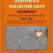
autumn2017vdposter-1-232x300.jpg
bearberry_3.jpg
bearberry_3.jpg
berries coastal BC banner.jpg
berries coastal BC.jpg
Biidaaban_FirstLight.jpg
black cottonwood drawing.png
black cottonwood.png
black cottonwood.png
blue_grouse_3.jpeg
Bracken fern.jpg
Pages
« first
‹ previous
1
2
3
4
5
6
7
8
9
…
next ›
last »
News
UVic Community Mapping Event!
SṈIDȻEȽ Volunteer days, February-March 2019!
Mapping Our Common Ground 2018 now available!
PEPÁḴEṈ HÁUTW̱ (Blossoming Place) morning tasting, ȽÁU, WELṈEW̱ Tribal School
ideafest: The Transformative Power of Maps and Stories
View all articles
August
«
»
S
M
T
W
T
F
S
1
2
3
4
5
6
7
8
9
10
11
12
13
14
15
16
17
18
19
20
21
22
23
24
25
26
27
28
29
30
31
Follow UVic Map Shop on:
This site (RSS)
Twitter


")
")
")
")
")