Date Start Course:
Thursday, March 22, 2012
Date End Course:
Thursday, March 22, 2012
Date Started:
2012
Date Completed:
2012
Year:
2012
Community Mapping session 2
seeing our neighbourhood geography
back to session 1
Environmental Studies | session 1 | session 2
Instructors:
Instructors: Ken Josephson (Community Mapping Initiative; Geography - Cartographer, Graphic Designer/Artist) & Dr. Brenda Beckwith (Environmental Studies Senior Lab Instructor)
Schedule:
- Community Mapping: local to global
- Break
- Art as a voice for research, learning and teaching
Reflection Questions:
- What do you personally think are signs of healthy sustainable communities or neighbourhoods?
- What does 'sense of place' mean to you?
- What characteristics, features or attributes contribute to a strong sense of, or attachment to, a 'place'?
Examples of local community maps:
- Coastal Community Green Map Project Visit the 'geobrowser' and explore some of the on-line place based stories
- ES 481 - Spring Project - 2009
- Open Green Map is GreenMap.org's participatory, interactive on-line map system
- Oak Bay Community Greenmap Puzzle - for a bit of fun, Ken discovered a way to create an interactive, on-line jig-saw puzzle from the most recently published, local greenmap
- Youth Portal of Greater Victoria
- Uni 201 - Community Based Art Project 2010
- UVic Community Green Map
- VICRA - Vancouver Island Community Research Alliance
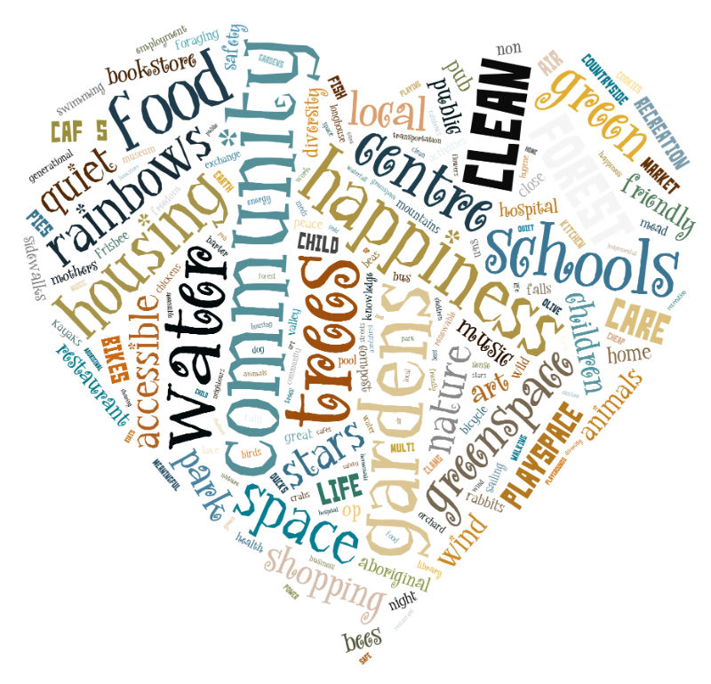
Here are a few images from Session 1
This is a 'word cloud' of our community planning game:
Links, references and videos:
LifeCycles project society - food, health, urban sustainability; fruit tree project; sharing backyards
The wish tree: fall 2011